
Geomatics (from the Greek Γη = Earth + μαθαίνω = learning + τέχνη = art; “the art of learning the Earth”) is an integrated and multidisciplinary approach, useful for studying the two-dimensional and three-dimensional distribution of the earth's surface as a function of known reference. Geomatics provides spatial information, based on the acquisition of analogue (eg, ground theodolite) and digital (eg, laser scanner, photography, photogrammetry, remote sensing) topographic data. The integrated multidisciplinary approach that characterizes geomatics concerns the following uses: (1) technologies for collecting data (hardware and sensors); (2) technologies capable of processing, processing data and providing information (software); (3) technologies capable of analysing, storing, distributing and managing georeferenced spatial data (databases).
Geomatics is made up of several disciplines, including Geodesy and Remote Sensing. Geodesy (from the Greek Γη = Earth + δαίω = divide) is the science that deals with studying the shape and dimensions of the terrestrial geoid, as a function of some parameters such as, for example, the terrestrial gravitational field (Gravimetric geodesy). Remote sensing (from the Greek τήλε = far + from the Latin relĕvare = to raise) has the aim of creating thematic maps of the territory through an indirect and remote measurement system. The acquisition of information takes place using antennas and sensors placed at a known distance from the area of interest, generally in relative motion (rotary and/or translational) with respect to the latter. These systems make it possible to obtain thematic maps of the territory with very large extensions, obtaining information on a determined physical phenomenon in relation to a more or less vast area, rather than on single points. Furthermore, using the interaction between the electromagnetic spectrum and matter, through specific sensors it is possible to discriminate the chemical composition of objects, exploiting the different phenomena of light propagation and studying the wavelengths (eg, VIS, IR, SWIR, TIR…) which characterize a signal deriving from a certain object and/or surface.
The activities of the Geomatics Laboratory transversally support the activities of the CNR-IIA and focus, in addition, on various scientific fields, including:
- Precision agriculture and evolution of a given crop (eg, water content, fertility and phenological stages);
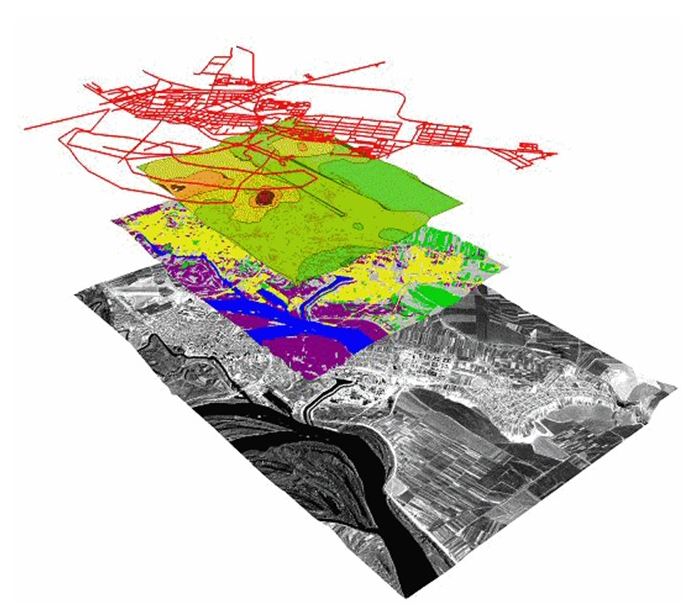
- Development of complex multi-source data flows in different environmental contexts;
- Application of sensors for the study of road surfaces;
- Study of territorial changes of both natural and anthropic origin (e.g. vegetation, hydrography, land use, urban areas, pollution);
- Development of innovative methods useful for the study of particular environmental problems such as detection and the evaluation of the wear of asbestos-cement roofing;
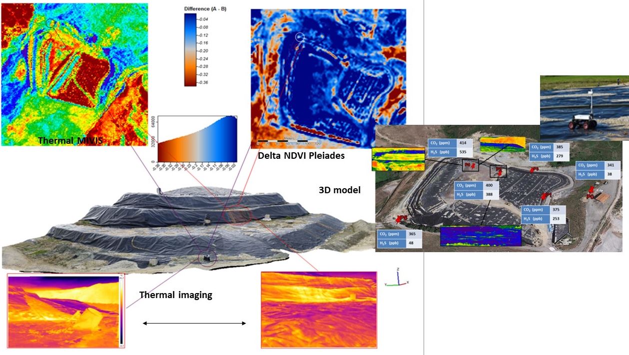
- Development of methodologies downscaling aimed at heterogeneous contexts such as the monitoring of areas subject to controlled and non-controlled landfills;
- Retrieval of above ground biomass using remote sensing techniques and numerical cartography;
- Geometric corrections of remote sensing images (satellite, airborne, drone) through orthorectification techniques with the aid of in situ gps surveys;
- Calibration/correction campaigns of images captured by remoto;
- Development of optical techniques for the separation of plastic and bio-plastic polymers;
- Application of remote sensing to archaeological investigations,
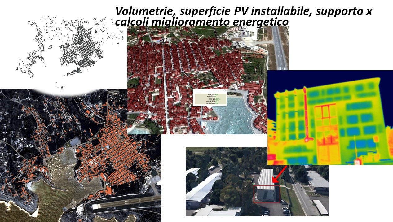
- Applications in the field of renewable energies.
- Creation of GIS and web-GIS
- Creation of web applications
Referent: Alessandro Mei