moira
Forest Monitoring: Fires and Recovery in Alta Murgia: MOIRA Program "Parks for the climate" Year 2020 - Satellite remote sensing project
Funding: Ministry of the Environment and Energy Security - Parks for the Climate
Period: September 2022 - August 2025
Total project budget: € 326.960,00
Total budget CNR IIA: € 75.000,00
Scientific Responsible: Sabino Maggi

Abstract of the project

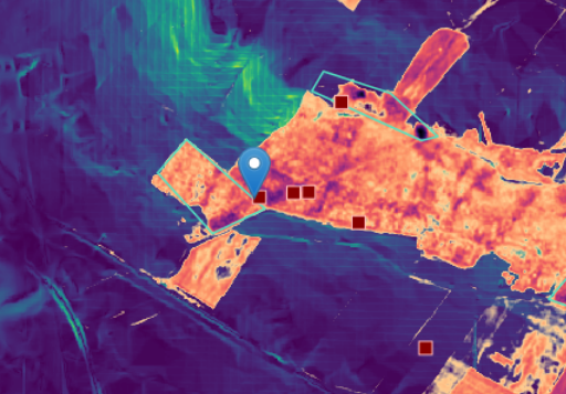
Earth observation using satellite remote sensing together with geographic information systems (GIS) are invaluable tools for fire monitoring and emergency management, risk assessment and, above all, for detecting burnt areas, estimating damage, preparing interventions recovery and follow the trajectories of the vegetation after the events. The European Copernicus program (https://www.copernicus.eu/it) facilitates the process of detecting burnt areas and monitoring their spatial evolution over time thanks to the high revisit time of the satellites of the Sentinel-2 constellation together with the Landsat Image History Archive. The objective that the Alta Murgia National Park pursues with this project proposal is to have information relating to the fires that have occurred and the response of the vegetation in the Park area. In this way, useful elements will be provided for the timely identification of the areas covered by the fire for their perimeter, characterization and control to support both the preliminary and timely planning of forest restoration interventions and their monitoring over time, and the updating of AIB plans according to the provisions of the law.
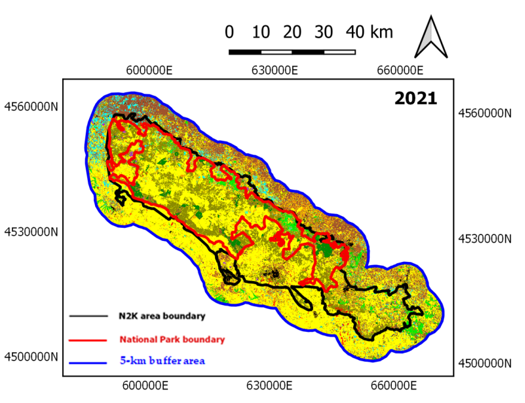
The object of the project intervention is the creation of an operational continuous monitoring service of the territory of the Alta Murgia National Park for the identification of the wooded areas covered by the fire through measurement techniques from remobased on remote sensing data from the Sentinel-2 satellites of the European Copernicus Programme, integrated with very high resolution satellite data (<2m), drone data, cartographic data and environmental information available online in open data mode (i.e. the information assets cartography of the Park). The project proposal therefore offers a tool of considerable support in the study of the state of the vegetation before and after the fire in order to identify preventive measures to be implemented, as well as calculate the damage after the passage of the fire and better calibrate the recovery interventions. It will constitute an essential support tool in monitoring the post-fire resilience phases. The project intervention falls under Categories 1.V1.3 Category 2 V.2.2 and more specifically under Category 3. "Warning systems to support surveillance, prevention and active fight", and in particular under the sub-category V.3.1 "Projects demonstrations that use innovative integrated management and control tools of geolocated data and other available information to increase and improve surveillance in the Parks for the purposes of the provisions of the AIB".
The objective that the Alta Murgia National Park pursues with this project proposal is to have information relating to the fires that have occurred and the response of the vegetation in the Park area. In this way, useful elements will be provided for the timely identification of the areas covered by fire for their perimeter, characterization and control to support both the preliminary and timely planning of forest restoration interventions and their monitoring over time, and the updating of AIB plans according to legal requirements.
Alta Murgia Park
CNR-IIA (Italy)


Sabino Maggi
Maria Patricia Adam
Silvana Fuina
Christine Tarantino
Xavier Vicar