
Evaluate the role of restoration actions in the climate change mitigation capacity of wetlands and in the provision of a broad range of ecosystem services, using an integrative approach to socio-ecological systems.
earth observation
MIA
Integration of in situ measurements and visible and microwave satellite remote sensing techniques to create a monitoring plan for eutrophic ponds and lakes
EO4CCS START AGAIN
Enhance the information of remote sensing data for the definition of new indicators and data analysis techniques based on AI for the study of Land Degradation
moira
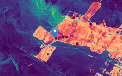
Forest Monitoring: Fires and Recovery in Alta Murgia: MOIRA Satellite Remote Sensing Project
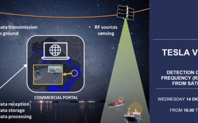
TESLA VISION
The TESLA VISION project develops a product for efficient monitoring of maritime traffic using satellite infrastructures
ELTR-PLUS
Abstract of the project
NEWLIFE4DRYLANDS
NEWLIFE4DRYLANDS Remote sensing oriented nature based solutions towards a NEW LIFE FOR DRYLANDS Funded by: LIFE2020 Period: January 2020 - June 2024 Introduction NewLife4Drylands aims to provide a framework and protocol to identify sustainable solutions that...
SMURBS
Abstract of the project
GEO-essential
Abstract of the project

E-SHAPE
Abstract of the project